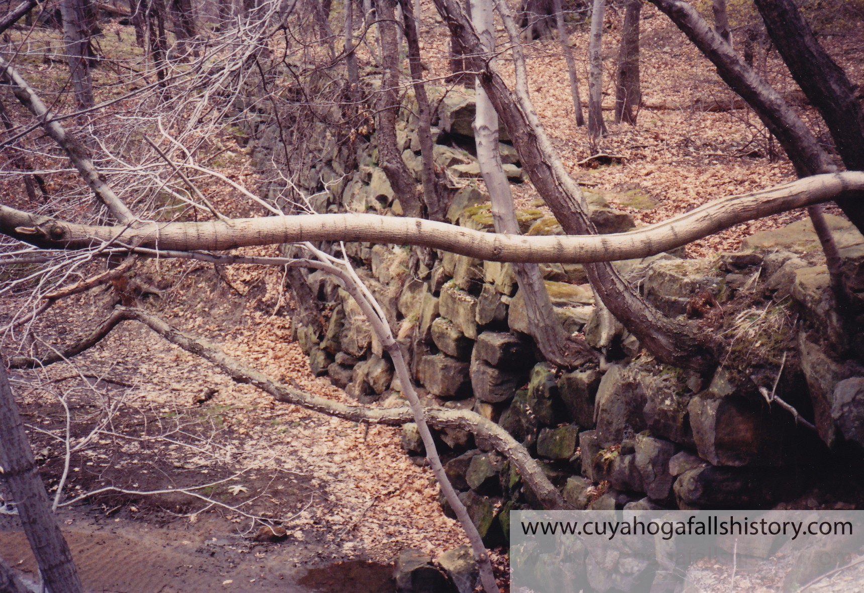
 When the Chuckery Race project went without repairs and eventually was forgotten, nature started taking over. In 1850 the lands were sold and a small portion of the debt was paid off. The Chuckery Dam washed out in one of the many river floods that graced the Cuyahoga. The portion of the Race on the eastern side of the Little Cuyahoga Valley, which had been built by filling ravines and cutting through sandy soil, began to wash away over the decades. The rock wall of hand-cut sandstone remained fairly intact. This section is thru Cuyahoga Falls from Prospect Street to the Front Street bridge that went over the river past the old Ohio Edison plant.
The High Bridge Glens Park was constructed in Cuyahoga Falls and opened to the public in 1882. The entrance was located at the bridge on Prospect Street off of Front Street, just 200 feet north of the old Chuckery dam. The park encompassed from there all the way to where Route 8 crosses the Cuyahoga River into Akron.
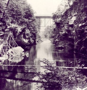
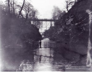 Both photos above show the same view at different times of the year. As you come down the stairs on the left, you cross the suspention bridge and to the right it leads you to the Grande Promenade.
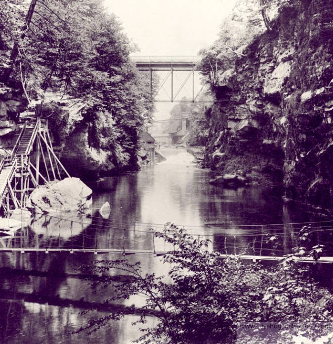
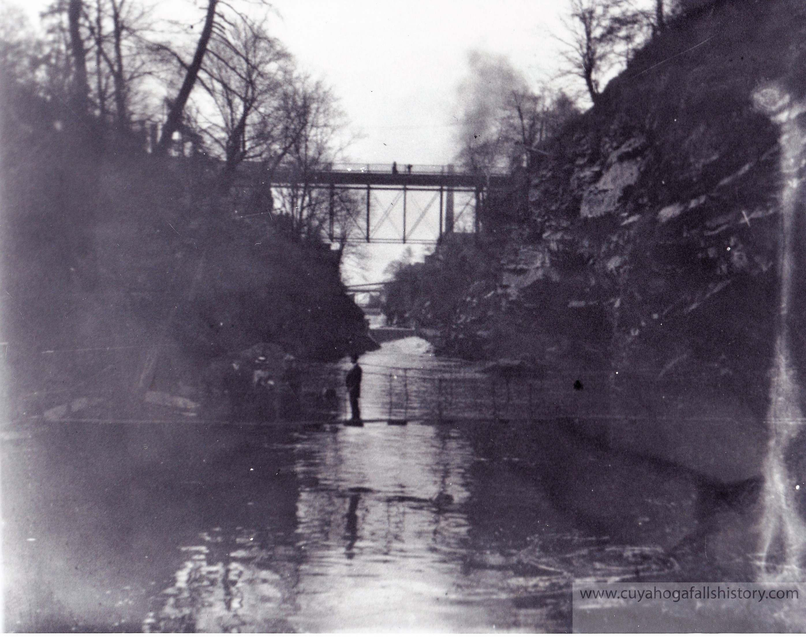
The High Bridge Glens included both sides of the river through the deep gorge and people came from all over to view the beautiful scenery. The park included picnic areas, shelters, dining and dance halls, roller coaster, croquet, caves, tree houses, a ferry, pedestrian suspension and cast iron bridges, an entire children’s section, and even kerosene lighted walkways. However, one of the most striking features was the main walkway through the park called the Grand Promenade which utilized both the rock wall and the bed of the Chuckery Race. Built along it were various sitting and picnic areas and even little gardens. The park operated until 1912, when construction of the N.O.T. & L. dam destroyed the scenery.
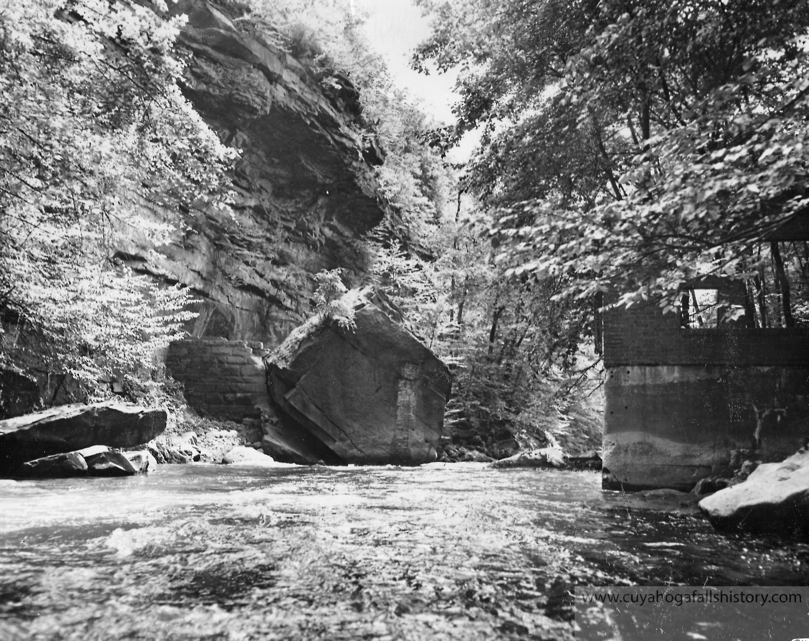
Shortly after the demise of the amusement park, Marathon Rubber Company moved in along Front Street and constructed a dam exactly where the old Chuckery dam was built, using the same Anchor Rock. In order for water to keep from escaping down the old Chuckery Race, they built a stone wall where a gate once existed. On the west side of the river they built a power house. Even today, remnants of both the canal and the power house can be seen. Of course the Anchor Rock hasn’t budged.
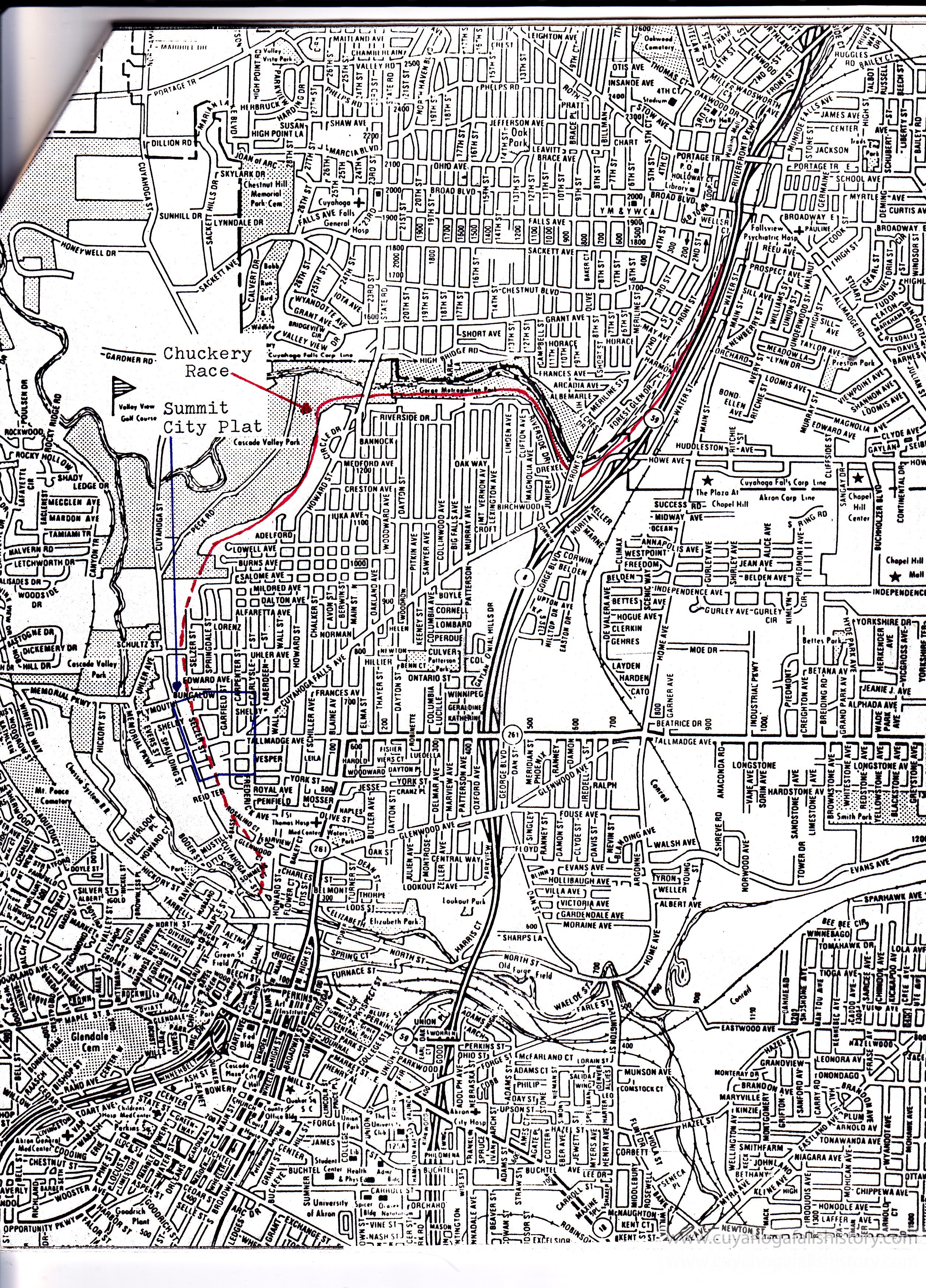
In 1972 the Chuckery Race became part of the National Register of Historic Places. The Akron Metropolitan Park District and Falls City officials sought the monument designation in order to protect the Race from encroachment by public projects. It’s a good thing too because the following year the Ohio Department of Highways began planning and constructing the Moulton Freeway. Without the Chuckery Race being on the NRHP, it would have been in serious danger of erosion and the local plant life would have been ruined.
Today parts of the Chuckery Race, mostly unknown or unseen, are used as our hiking and biking trails in the Gorge and MetroPark.
www.summitmetroparks.org/ParksAndTrails/CascadeValleySouth.aspx
www.summitmetroparks.org/ParksAndTrails/Gorge.aspx
Mary McClure’s book High Bridge Glens
High Bridge Glens Facebook Page
I am wondering, where did you find a route map the indicates the location of the chuckery? I have looked in vain to locate any existing parts south of the High Level bridge.
It is located at the Cuyahoga Falls Historical Society Museum