*This is just a basic run down of what the Chuckery Race was/is. If you want more specific details like dates, names, etc – I’ll be posting documents and writings after this.*
Dr. Eliakim Crosby, who had previously completed the successful Cascade Mills in the 1830’s decided to begin a new project. He had plans for a new manufacturing town that would be larger than Cuyahoga Falls and Akron, in fact, he boasted that it would be larger than the most prosperous towns in New York and New England. He acquired 2,500 acres in today’s Cuyahoga Falls and Akron including the gorge and river area. Dr. Crosby designated 200 of those acres as “Summit City” – in the area today known as “North Hill” in Akron. Invitations were sent to the east coast to come to the area and invest in manufacturing, businesses and private lots.
On February 27, 1837, a charter was granted to Dr. Crosby and a bunch of other important Akron men under the name of The Portage Canal and Manufacturing Company with authorization to sell bonds to construct a dam and canal. The purpose of the canal was to provide water power for the manufacturing developments in Summit City.
Very quickly the canal became known as the Chuckery Race. As the story goes: When a stranger came to the territory asked about the population of this new Summit City, Colonel John Nash replied to him that it was “about 10,000 – one man and nine thousand, nine hundred and ninety nine woodchucks.” The new city just wasn’t taking off as quickly as expected and the name Chuckery Race developed and stuck.
Although the grand scheme began in 1837 it was stopped due to “distresses” later that year. It began again in 1840 but stopped once again. When it began a third time, a fire was lit under 100 men to get it done quickly.
One thing to mention that about the time the Chuckery Race and Summit City was being planned and platted, although it wasn’t the only reason for trouble, there was a fierce battle between Akron and the Falls over the county seat. So when this third prospect came into view it added more fuel to the fire, not the compromise as they’d hoped. I can only imagine the anger and tension. There was lots of bickering and outright vandalism going on regarding the early Chuckery construction. The Falls was initially chosen and then snatched away and then finally in 1842 Akron was chosen as the county seat. But that’s going into a whole other story…
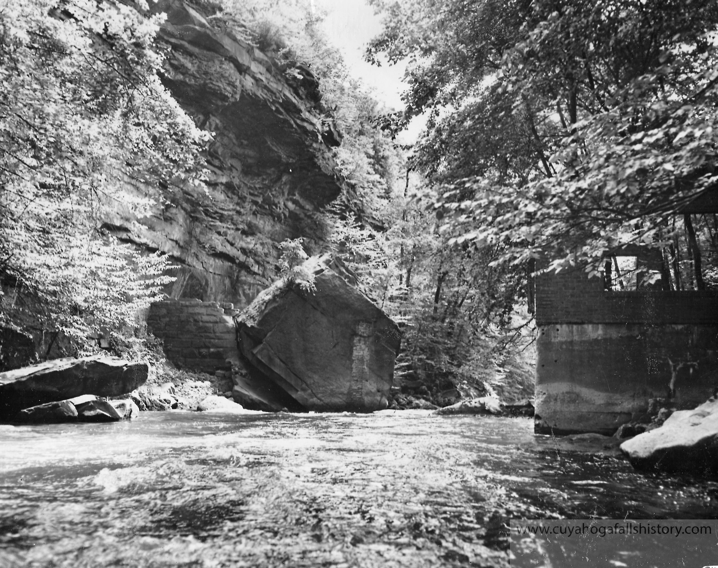
The Chuckery Race began at the dam about 200 feet south of where Prospect Bridge is still located (High Bridge Glens area). The dam, located 90 feet down into the gorge, was completed in 1843. The chute of water from the dam was built for four miles. For the first two miles, the Race was either cut from the solid rock of the overhanging cliffs or built up with rock and stone. The other two miles continued southward but leaving the Gorge and entering the upper lands of the proposed city. This portion of the Race was difficult, even compared to the sheer cliff walls of the earlier portion because it was 100 feet above the riverbed and it had to be constructed through sand bluffs. But finally early in 1844 the Canal was completed!
On the 27th of May, 1844 at 4pm they let water into the opening of the canal. Aware of the day and time there were lots of people from Summit City, Akron, Cuyahoga Falls and the surrounding country side to see the event. As water began to flow there were cheers and ringing bells.
The first two miles through the gorge the water made its way through pretty well but once it reached the sandy plateau the water slowed down and became foamy and began leaking. Despite that, water reached the end where another large crowd gathered and upon seeing the water slowly make its way to the end they raised three cheers and fired a cannon.
It was obvious that work on the Chuckery Race was still necessary before it was operable. However, it was never completed. Conflict among the stockholders, legal problems, lack of funds, and the location of the county seat in Akron all led to the collapse of Summit City and the Chuckery Race scheme.
Next! Part 2 – Land changes hands & the Chuckery is used as apart of the High Bridge Glens Park
The info used in this post I gathered from Samuel Lane, Carl Ehmann and the Historic Register.
Hello there. My name is Dale E. Wise and I’m replying to you in regards to this article about the Chuckery. I am writing to you because my great grandfather lived on the hill in North Akron and I believe, according to the obituary I have read, he lived at the Chuckery. His name was George H. Wise and he died in 1880. Evidently he was quite wealthy because his estate was valued valued at $60,000 at that time. I have always been interested in my heritage and if by chance you have any information about George H. Wise and his place in Akrons history I would really appreciate it because I can’t seem to find anything except for his gravestone.I look forward to hearing from you and if you wish to call me my number is 1-440-487-4025. Thank you.