WaterWorks Park
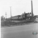
Denver Chatman’s on the Cuyahoga River was for years the favorite swimming hole for Cuyahoga Falls youth and for three generations the schools’ truant officer could count on finding local school truants in the spring at that spot. Local outings and scout groups used the area and it was an ideal location for large fireworks displays. The Denver Chatman farm was located where WaterWorks Park is now. WaterWorks Postcards More WaterWorks Park Below
A man by the name of Hugh Galt gifted our city with land for Galt Park just off Northmoreland Boulevard on the far east side. Its community house along with its athletic facilities, play area, and picnic areas are a pleasure for many gatherings. Galt Park Photos
Oak Park on 12th Street at Jefferson Avenue was given to the city by developers of Akron Gardens Allotment as a site unfit for development and, today, besides serving the city with a water standpipe site and electrical transformer building, it has a picnic shelter, tennis courts, children’s wading pool, small ballfield and lots of playground equipment.
Harrington Field on Oakwood Drive and Roosevelt Avenue was owned by Fire Chief Myron Harrington, Sr. in 1922, when Falls High opened at its present location and Chief Harrington, who also operated the local ice manufacturing plant, donated his field to the high school for its athletic activities and athletics, in general, came to count on it for all public activities. The city Parks and Recreation Commission got it equipped for night soft or slow-pitch ball, while still serving as a playground for Bode School and in its expanded area is well equipped for year-around playground activities.
Rowena Ross Park on the north end of Maplecrest Street, with additional entrances on Charles Street, is in the far north side of town and due to its ground connection with Roberts Junior High, serves that school’s athletic activities, while supplying a night ballfield, additional ballfields and supervised playground for the public. The city also has a large underground public water supply holding tank to ensure ample supply for the northern area of town. Rowena Ross Park got its name from a Falls High girl who volunteered for military service with the United States Forces during World War II and was the first Cuyahoga Falls girl in our history to die in the service. She died in New Guinea and her memory has been perpetuated by the award annually to a Falls High girl graduate of the “Rowena Ross Womanhood Trophy Award”.
Valley Vista Park on Portage Trail, on the far west side of the city, was given to the city by Heslop Development Co. and besides serving the city’s Electrical Light Department with a large transformer station, has a recreational area for tennis as well as a large playground equipped area. Photos
Lions Park at Sixth Street and Silver Lake Boulevard runs through to Monroe Avenue. It was donated to the city by the Cuyahoga Falls Lions Club, who also initially developed the lodge building and play areas. Lions park was the first to have the only lighted basketball court along with public playground equipment. Photos
Just west of Lions Park on the southwest corner of Silver Lake Boulevard and 13th Street, we have Newberry Park with its large complex of Newberry School and Bolich Junior High with their large variety of athletic fields as well as a lighted football field and the city’s only outdoor running track. Besides the usual playground equipment, picnic areas and recreational facilities, it also has a hill for winter sledding and an open-air Kiwanis Sylvan Theatre, all available to the public in season.
Again, on the far east side, south of Munroe Falls Avenue, across from the entrance to Water Works Park and back of the city water treatment plant, and in conjunction with Schnee School, we have four baseball fields in Schnee-Kennedy Park. Photos
Trails End Park, on the east side of High Street, opposite the east end of Portage Trail, was known as the Murray Carnival Grounds prior to 1951 when the Little League organization took it over and built two Little League baseball fields with bleachers and fenced it in. It is now a part of the City Park and Recreation System and the wooded area around the fields has been developed into picnic areas and playground equipment has also been added.
On the west side of Bailey Road on top of the hill is Indian Mountain Park with the water department standpipe on the southeast section. The park provides limited recreation and some playground equipment.
Preston Park on the east side between Taylor Street and Loomis Avenue is in conjunction with Preston School at 800 Tallmadge Road on the old “Ratta” farm and is named to honor H. A. Preston, an outstanding Falls High teacher for many years, starting in 1922. The Preston complex has recreation, picnic and play areas.
Linden Park on the north side of Cuyahoga Falls, is a full block in size and is bounded by Norwood and Kilarney Streets and Alameda and Roanoke Avenues and was named for the beautiful Linden trees that adorn the park. The original allotment developer donated half the block for park use and the city traded old lots on the abandoned Keenan ballfield to builders for the balance of the block, thus having a full block. A ballfield and recreation area, along with a small pool and picnic area with equipment is available. Photos
Babb Run Bird and Wildlife Sanctuary runs from the corner of Sackett Avenue and 27th Street south to the Cuyahoga River at the Slip Bank and is open for exploring by the public and has a spring-fed stream running its full length and was part of the original George Babb Farm. As early as 1912 the stream was stocked with trout by the Goodyear Sportsman’s Club who used the valley for a wildlife haven. Today it has no trout but it still has that natural refreshing atmosphere in historic surroundings. There was an entrance to the Babb Run Park at the west end of Valley View Drive with a wooded drive clear through to Sackett Avenue. Now only access via Sackett Ave.
Continuing up the river from the old turbine house we go under the expressway bridge to Riverfront Park. Within this park is the old Nauvoo Rock where the Old Swimming Hole was adjacent to the Doodlebug Bridge. The old Nauvoo Rock looks just as it had hundreds of years ago with the exception it being cut to allow a storm sewer drain to dump into the river. This land was taken for the expressway by the right of eminent domain. After the expressway was completed the state didn’t want to have to maintain that land. So they offered it to Cuyahoga Falls on a 25-year lease for $1.00. The lease was up in 2005. Picnic tables, grills, running water, restrooms 2 fishing piers and one small boat launch.
Across the Doodlebug Bridge is the old Gaylord Grove Park which was also the location of Camp Foster during and after the Civil War. Old pleasure steamboats used to occupy the river this time. They would land on Goose Egg Island where over 200 years ago Chief Wagmong of the Seneca Indians lived and then it was William Lodge’s Bird Sanctuary. Camp Foster


